1750 to 1919 The enclosures acts
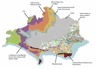
By the 1750s The heath lands of Dorset spread from the Avon Valley in the East, across Purbeck as far as Dorchester in the West. There was 50,000 Hectares of heathland crossed only by the river valleys of the Piddle, Frome and Stour.
The heath played an important part of the rural economy and local communities took a living from them until the enclosures act of 1805 which determined much of the ownership of the heath.
The enclosures that occurred between 1750 and 1820 dispossessed former occupiers and farmers from some 30 percent of the agricultural land of England. Through the Acts, “open fields” and “wastes” these lands were closed to use by the peasantry.
Open fields were large agricultural areas to which a village population had certain rights of access and which they tended to divide into narrow strips for cultivation. The wastes were the unproductive areas for example, heathlands, fens, marshes, rocky land, or moors to which the peasantry had traditional and collective rights. Including access in order to pasture animals, harvest meadow grass, fish, collect firewood, or otherwise benefit. (7)
Rural labourers who lived on the margin depended on open fields and the wastes to fend off starvation. This meant if you were not a land owner you had to accept the situation or give up the way of life and move to the increasing industrial towns and cities to earn a wage. This was at a time when the first Industrial Revolution was beginning to change society in major ways.
They hang the man, and flog the woman,
That steals the goose from off the common;
But let the greater villain loose,
That steals the common from the goose.
English folk poem
 |
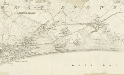
| Bournemouth Map 1870 (click to enlarge) |
 |
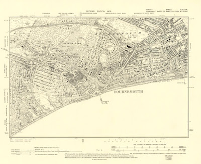
| Bournemouth map 1900 (click to enlarge) |
In 1851 population of Bournemouth was 695, by 1881 the population has increased to 16,000. (8) This was helped by the new train routes where Victorians would come for the pine walks and sea air as a remedy to help cure Tuberculosis a common disease at the time.


No comments:
Post a Comment