Showing posts with label Bronze Age Walks. Show all posts

Wednesday, July 19, 2023

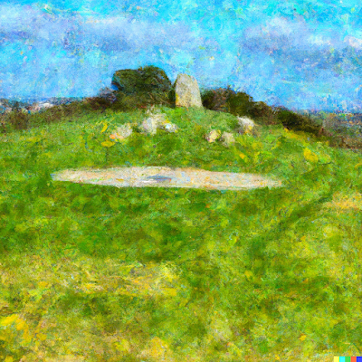
Bronze Age walks The History of Cairn Barnenez: Possibly the oldest building in the world


Cairn Barnenez, located in the Finistère region of Brittany, France, stands as a remarkable testament to human ingenuity and architectural prowess. This prehistoric burial mound, dating back several millennia, has captivated the imagination of historians and archaeologists alike. In this essay, we will delve into the rich history of Cairn Barnenez, exploring its significance and addressing the question of whether it can be considered the oldest building in the world.

Ancient Origins:

Cairn Barnenez, also known as the "Tumulus de Barnenez," was constructed during the Neolithic period, around 4,500 to 5000 BCE. The cairn consists of two main burial chambers, adorned with monumental stone slabs, which were carefully arranged to create a structure of imposing grandeur. This complex funerary monument was created to honour and commemorate the dead, and it stands as a testament to the early societies' beliefs and rituals.


Architectural Marvel:

What makes Cairn Barnenez truly exceptional is its sophisticated architectural design. Comprising of a long passage leading to a central chamber, flanked by smaller chambers on either side, the cairn demonstrates a remarkable level of planning and engineering skill. Some of the massive stones used in its construction, weigh over 20 tons and were skilfully manoeuvred and placed to create a stable and enduring structure.


Historical Significance:

Cairn Barnenez offers valuable insights into the cultural and social practices of Neolithic societies. The careful construction of the cairn indicates a high level of communal organization and the ability to mobilize significant resources. The presence of burial chambers suggests complex funerary rituals and the importance given to ancestral reverence. The site serves as a link to our ancient past, enabling us to study and understand the lives of those who came before us.

The Debate on Oldest Building:

While Cairn Barnenez is undoubtedly one of the oldest surviving architectural structures, the claim that it is the oldest building in the world remains a subject of debate. As our understanding of ancient civilizations expands, new discoveries constantly challenge previously held notions. Numerous other structures, such as Göbekli Tepe in Turkey or the Megalithic Temples of Malta, have also vied for the title of the world's oldest building.


But if you define a building as a structure made by humans that has a roof and an entrance that people can move in then the Cairn Barnenez in my opinion is the world's oldest building. Attempting to determine the absolute oldest building is a complex task. The dating of ancient structures relies on various factors, including archaeological evidence, carbon dating, and cultural context. It is an ongoing process that requires constant reassessment and reevaluation as new information emerges.

Conclusion:

Cairn Barnenez stands as an awe-inspiring testament to the skills and aspirations of our ancient ancestors. Its construction and historical significance offer valuable glimpses into Neolithic societies and their reverence for the deceased. While it may not be definitively proclaimed as the oldest building in the world, its importance cannot be underestimated. The study and preservation of Cairn Barnenez contribute to our understanding of human history and allow us to appreciate the remarkable achievements of our ancestors.


Friday, June 16, 2023

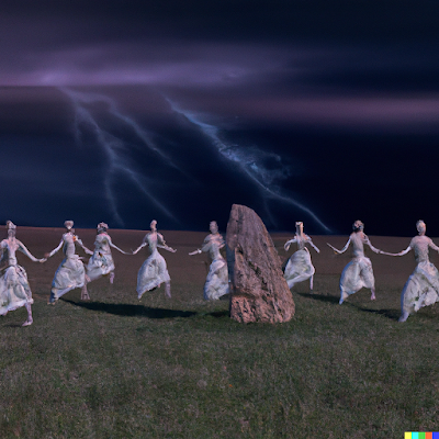
The Windycrest dancers who were turned to stone

Nestled in the picturesque countryside of southern England, there was a majestic hill fort known as Windycrest. It stood tall and proud, overlooking the lush green valleys and woods below. Legends whispered that this hill fort was not only a place of strategic importance but also a realm of enchantment and mystery.

Within the vicinity of Windycrest, hidden amidst a grove of ancient oaks, lay a meadow bathed in ethereal beauty. It was said that this meadow was once a sacred gathering place for a troupe of extraordinary female dancers. These dancers possessed grace beyond compare, and their performances held the power to captivate even the coldest of hearts.

Led by their enigmatic leader, the renowned Melisande, the dancers weaved their bodies in harmony with the rhythm of nature. Their movements were like poetry in motion, their feet floating above the earth as if defying gravity itself. Each dancer was a vision of elegance, their flowing dresses and radiant smiles filling the air with a sense of awe and wonder.


But amidst the enchantment, there lurked jealousy and malice. A sorceress Morgana, envious of the dancers' beauty and the adoration they garnered, concocted a wicked plan. Using her dark arts, she cast a malevolent spell upon the meadow, turning the unsuspecting dancers into a circle of stone.

As the moon waxed and waned, the stone circle stood dormant, its true nature concealed from the world. But when the new moon rose in the sky, and the solstices arrived, the meadow would come alive with magic. The stone circle would momentarily return to its former glory, and the dancers' ethereal forms would emerge from the stones.

At these mystical times, those fortunate enough to witness the spectacle would be treated to a wondrous display. The stone dancers, bathed in moonlight, would gracefully sway and twirl, their movements echoing the melodies of the wind. The air would be filled with a hauntingly beautiful music, as if the spirits of the dancers still lingered within the stones.

Visitors from far and wide would flock to the meadow during these rare moments, drawn by tales of the magical spectacle. They would gather at the hill fort, their hearts filled with anticipation and reverence, awaiting the manifestation of the stone dancers.


But as the first rays of dawn kissed the horizon, the stone dancers would return to their inanimate state. The meadow would regain its ordinary appearance, as if the enchantment had never occurred. Yet, the memory of the stone dancers would linger in the hearts of those who had been touched by their ethereal beauty.


And so, the meadow near Windycrest hill fort became a place of wonder, where the legacy of the dancers lived on. Their stone forms continue to enchant and inspire, reminding all who bear witness that magic exists in the world, even in the most unexpected places.

Wednesday, August 12, 2020

Bronze Age Walks The Oldest living inhabitant in Dorset

Bronze Age Walks The oldest living inhabitant in Dorset


©paint walk July 2020
Bronze Age Walks - The Oldest living inhabitant in Dorset at St Mary’s Church, Lychett Matravers, Dorset


A walk to locate an ancient Yew tree about 1750 years old in Lytchett Matravers in Dorset. 


(50°45'45.4"N 2°05'17.9"W) Walk starts at Colehill Road


(50°45'54.0"N 2°05'32.7"W) St Mary the Virgin Church


(50°45'54.7"N 2°05'32.9"W) The Yew tree (circa 280 A.D.)


Bronze Age Walks are a collection of short, filmed walks with maps defining ancient sites.


(50°45'45.4"N 2°05'17.9"W) Walk starts at Colehill Road.

©paint walk July 2020
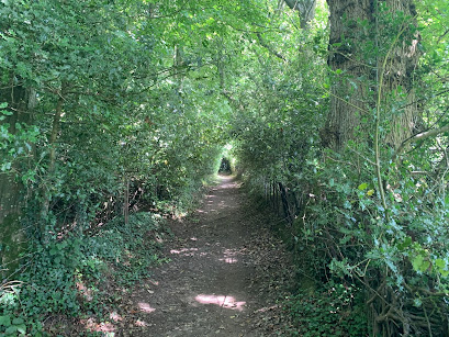
Go through the side gate and continue through the trees.
©paint walk July 2020

Then the walk gets steeper towards a bend. The last time I went it was dry but I do remember that it can get muddy after heavy rain. At the bend is a seat looking towards the church. 

©paint walk July 2020

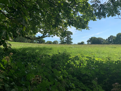
From here the walk becomes shallower and starts to open out into fields.

©paint walk July 2020

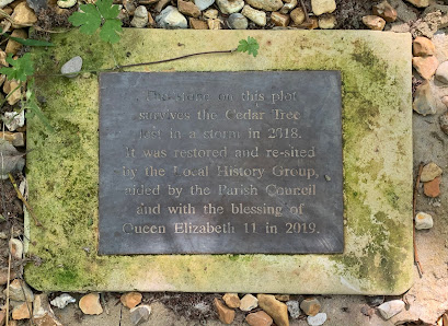
On the left is a fenced cutaway celebrating a tree that was planted in 1938 and blown over by a storm in 2018. This was marked by a two plaques showing the dates. It is clear that the people of Lytchett have a relationship to their trees!

©paint walk July 2020

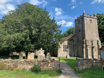
As you walk down past through the graveyard and past the church to the west side you will find the two yews. The closest to the gate is the oldest.

©paint walk July 2020

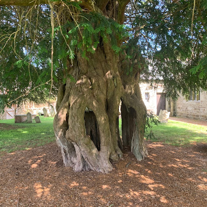
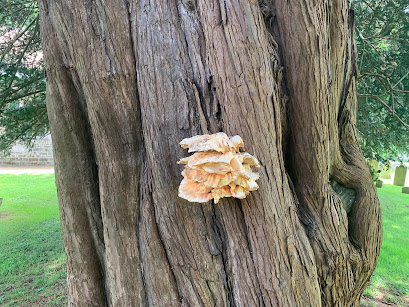
In the churchyard, just outside to the west is a yew tree that in the 1980s was dated to be at least 1,700 years old. Its location here next to the church suggests the spot has been a holy place since before the current church was built.

©paint walk July 2020
The Yew has a girth of 7 metres its possible to stand in the middle of the trunk. The Yew tree is largely poisonous and has a long history within Paganism.  


HISTORY


Lytchett Matravers was recorded in the Doomsday book of 1086 where it was part of the Cogdean Hundred. The Hundred refers to an administrative division of a larger geographical area.


In 1066 a Danish lord called Tholf held the Manor of Lytchett but after the Norman invasion it was granted to Hugh Maltravers whose family held the area for the next 300 years. 


Around 1200 The Church was built by the manor possibly during the crusades when the knight would have been in absence. Within the churchyard are two Yew trees one of which turned out to be 1700 years old. 


This would make the tree in place some at 280 AD  nearly 1000 years before the church was built. WIKI REF: Lychett Matravers Yew Tree.


Please take a look at the video 

https://youtu.be/hQ-33Kx98Rw


To put this in European historical context The Roman Empire was still the dominant power and regional religion would have largely been Pagan. 


It is possible that Sir Walter Maltravers ordered the church to be built beside the manor house during a crusade in his absence around the year 1200. Next to the church are two large yew trees. One of which was dated in the 1980s to be at least 1700 years old.


Bronze Age Walks


Bronze Age Walks with an iPhone are a collection of short, filmed walks with maps defining ancient sites. The emphasis is on Neolithic, Bronze Age and Iron Age because I find them a good lodestone for a walk. 


The walks are usually not a great distance so you don’t have to be super fit to do them. In fact Bronze Age Amble would work. They largely stick to recognisable paths but it is probably a good idea to protect your legs a bit as gorse can be fairly prickly and common in places.


Bronze Age Walks

Cannon Hill 3 Bronze Age Barrows

Summerlug barrow and hill - Holt Heath - Wimborne - Dorset

Bronze Age Walks-Bee-Garden-Holt-Heath

Bronze Age Walks The Oldest living inhabitant in Dorset


Dorset heathland
Part 1  Part 2  Part 3  Part 4 


Monday, July 13, 2020

Bronze Age Walks - The Bee Garden - Holt Heath - Wimborne - Dorset

A walk to locate the Bee Garden. An earthwork enclosure  on Holt Heath National Nature Reserve. 


Holt Heath is a protected National Nature Park North of Wimborne Minster in Dorset.


Bee Garden (50.836802, -1.922901)

Parked at map ref (50.8322705,-1.9350979,509)


Bronze Age Walks are a collection of short, filmed walks with maps defining Bronze Age sites.


Please take a look at the video 

https://youtu.be/SrADjozUciI

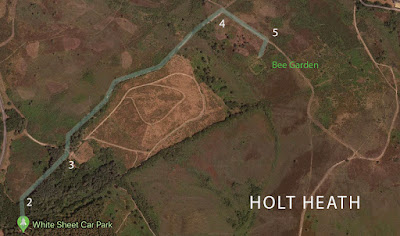
Walk starts from the White Sheet car park at the parking label on map.

Google maps
Map Of Bee Garden Walk (Click to enlarge)

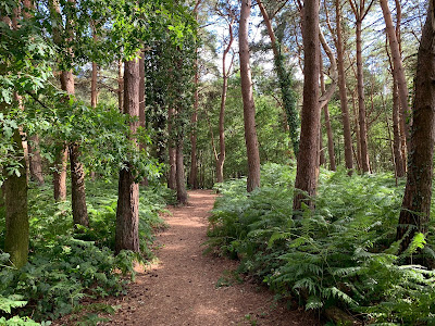
Walking from the car park go through the small gate on the north side of the car park. This will take you a short distance through some woods where you join another track and go right.


Carry on until the woods end and you will find a three way path. Take the left-hand path towards the road And follow it until you reach a crossroads.

©paint walk 2020

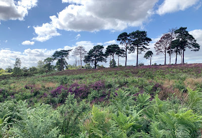
Turning right at the crossroads there is a shallow descent down a wide path.  Passing a line of Scots pine on the right you come to the entrance of the Bee garden. 

©paint walk June 2020
This was quite  hard to find. The gorse had grown thick and the entrance is completely obscured. I Walked back about 20 feet and went round the edge of it.
©paint walk July 2020

Walking diagonally you can find small paths. you will definitely notice the ditch and ramparts. The ramparts is about a metre high and the ditch about the same. From the bottom of the ditch its height is about 2 m or 6 1/2 feet. it’s a steep scramble to the top.

Artist illustration of a medieval bee garden

Ramparts are well defined and it looks to be squarish in shape. It’s actually 26.5 x 22.8 metres (29 x 25 yards) in size. There are some really good views of the heath from here. I went in June and the purples and yellows were just starting to come out.

©paint walk 2020

HISTORY


Bee gardens were an important part of heathland life from the Medieval period. The hives had changed little since the Roman occupation. Bell shaped baskets called Skeps were put on small platforms that could be moved throughout the pollen season. 

Artist impression of a heath bee garden

The main product of the bees work was the honey and beeswax they produced. Honey was used both for food sweetening and also for the many medicinal purposes it can perform. Fermented honey also made Mead a medieval beer.


But beeswax was the most profitable product for the beekeepers. The beeswax was used for the church candles because the tallow candles the commoners used was considered of an impure light and too smelly for services. It was also in demand by the nobility of the times both for lighting and wax seals.

The Beekeepers, 1567 by Bruegel the Elder

This area of Holt heath is still known as the Bee garden today and its rectangular shape would certainly keep the worst of the wind and weather from the skeps. But if this was built as a bee garden then the earthwork enclosure built round it at some 2 - 3 metres in height seems like a fortification .


This would be far more practical as an animal enclosure or as a local meeting place similar to a Moot still visible in the area. Is it Bronze Age? Maybe, maybe not and until some excavation or ground work is done the answer is unknown.    


ABOUT BRONZE AGE WALKS


Bronze Age Walks with an iPhone are a collection of short, filmed walks with maps defining Bronze Age sites. The emphasis is on Neolithic, Bronze Age and Iron Age because I find them a good lodestone for a walk. 


The walks are usually not a great distance so you don’t have to be super fit to do them. In fact Bronze Age Amble would work. They largely stick to recognisable paths but it is probably a good idea to protect your legs a bit as gorse can be fairly prickly and common in places.


Bronze Age Walks

Cannon Hill 3 Bronze Age Barrows

Summerlug barrow and hill - Holt Heath - Wimborne - Dorset

Bronze Age Walks-Bee-Garden-Holt-Heath

Bronze Age Walks The Oldest living inhabitant in Dorset


Dorset heathland
Part 1  Part 2  Part 3  Part 4 


Monday, July 6, 2020

Bronze Age Walks - Summerlug barrow and hill - Holt Heath - Wimborne - Dorset


©paint walk June 2020A walk to locate a Bronze age barrow on Holt Heath National Nature Reserve. 


Holt Heath is a Nature Park North of Wimborne Minster in Dorset.


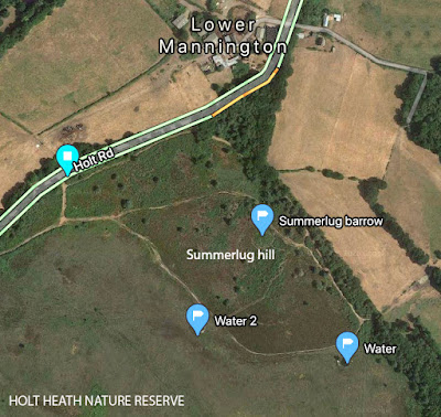
Summerlug barrow (50.8430860, -1.9038620)


Summerlug hill (50.8426202, -1.9040965)


Parked at map ref (50.8436743, -1.9082170)


Bronze Age Walks are a collection of short, filmed walks with maps defining Bronze Age sites.


Please take a look at the video 

https://youtu.be/1nNY6dE-FGY


Walk starts from Holt road at the parking label on map.
Summerlug Hill - Bronze Age Walks
Map of Summerlug Hill

Walk from the entrance till you meet the main path and turn left. Keep walking until you come to a fork in the path. I went left around the north of the hill. You can go left or right here it doesn’t really matter, as it’s a circular walk. 

©paint walk June 2020

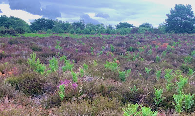
Summerlug hill is on the edge of the heath. You can find gorse, bracken and foxgloves in plenty at the right time of year. Occasionally you can hear Curlew calls.
©paint walk June 2020

Just round the top of the hill you can find Summerlug barrow on the right hand side. It’s not signposted. The problem with finding the barrow depends on the time of year and how overgrown it is. 
©paint walk June 2020
Summerlug barrow looking west. The barrow is on the right.
(click to enlarge)
The path entrance will be visible and its on the right. Once you see the mound it will be more obvious because its not far from the entrance.
©paintwalk jun 2020
Summerlug hill (click to enlarge)
After going back onto the original path turn right down the hill. As it descends the heath opens out and you can take the wider paths to the right along the south side. 
©paint walk June 2020


The views give a good panorama of Holt heath. Following the path back up the west of Summerlug hill you meet up with the start of the walk and you are pretty close to the entrance again.

©paint walk June 2020

HISTORY


Possibly the three barrow marks a boundary of land ownership but as this is near the edge of the current heath boundary it is difficult to decide. To the North West is another barrow so it seems likely that these two would be related to each other. As with most heathland the landscape has remained largely unchanged for 3000 + years.


ABOUT BRONZE AGE WALKS


Bronze Age Walks with an iPhone are a collection of short, filmed walks with maps defining Bronze Age sites. The emphasis is on Neolithic, Bronze Age and Iron Age because I find them a good lodestone for a walk. 


The walks are usually not a great distance so you don’t have to be super fit to do them. In fact Bronze Age Amble would work. They largely stick to recognisable paths but it is probably a good idea to protect your legs a bit as gorse can be fairly prickly and common in places.


Bronze Age Walks

Cannon Hill 3 Bronze Age Barrows

Summerlug barrow and hill - Holt Heath - Wimborne - Dorset

Bronze Age Walks-Bee-Garden-Holt-Heath

Bronze Age Walks The Oldest living inhabitant in Dorset


Dorset heathland
Part 1  Part 2  Part 3  Part 4 


Historic England Maps and information.

https://historicengland.org.uk/listing/the-list/list-entry/1015999


Friday, June 26, 2020

Bronze Age Walks - Cannon Hill - Wimborne - Dorset

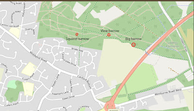
A Walk to locate 3 Bronze Age barrows closely spaced. Bronze Age Walks, Cannon Hill near Wimborne, Dorset.


Squirrel barrow (50.8088941N, -1.9440899)

View barrow (50.8089912N, -1.9395161)

Big barrow (walk barrow) (50.8086410N, -1.9379360)


Bronze Age Walks with an iPhone are a collection of short, filmed walks with maps defining Bronze Age sites.


Please take a look at the video https://youtu.be/87vWTWxtgtM


Walk starts at Bridle Way - Google Maps ref  (50.8075111, -1.9438680)

Paintwalk.com
Map of Cannon Hill Barrows (click to enlarge)

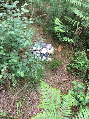
Walk up the hill until you see an information sign then go left for about 200 yards. The clearing on the right contains the Squirrel barrow so called because, loads of squirrels. The site not been excavated but the low barrow can be made out under the Bracken. If you find this barrow you may find signs of recent visitors. Squirrel barrow is the most hidden of the three Bronze Age barrows.
paint walk.com

Next go back to the main path and when you reach it walk up the hill until you come to a crossroads. Turn right and then keep going until you reach a fork. take the left hand route and you will see View barrow within 20 metres. 


It’s called View barrow because on the North side is a pretty spectacular vista due to the steep drop looking out over the heath towards Mannington and Cranborne Chase. Nice touch that some seats have been placed here to admire the view.


Take one of the paths back to the fork and go down the hill. if you are on the correct path you should start to see some open farm fields to your right. Keep following this path until you reach a large mound that the path appears to go over. 


You are now looking at Big barrow, the largest of the three. There is a path around it that looks like it was forgotten about for years. Now the track has developed to go over it as it became the path of least resistance.

HISTORY

Possibly the three barrows mark a boundary of Bronze Age ownership because two of the three are large and prominent enough to be visible from a distance on the landscape. This is oddly clear today, because they all now reside on a modern boundary. One side is Houses and Farms and the other side is the Cannon Hill Plantation and the heath.

Bronze Age Walks with an iPhone are a collection of short, filmed walks with maps defining Bronze Age sites. The emphasis is on Neolithic, Bronze Age and Iron Age because I find them a good lodestone for a walk. 
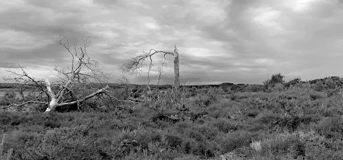

The walks are usually not a great distance so you don’t have to be super fit to do them. In fact Bronze Age Amble would work. They largely stick to recognisable paths but it is probably a good idea to protect your legs a bit as gorse can be fairly prickly and common in places.


https://historicengland.org.uk/listing/the-list/list-entry/1015999

Historic England Maps and information.


Bronze Age Walks

Cannon Hill 3 Bronze Age Barrows

Summerlug barrow and hill - Holt Heath - Wimborne - Dorset

Bronze Age Walks-Bee-Garden-Holt-Heath

Bronze Age Walks The Oldest living inhabitant in Dorset

https://www.paintwalk.com/2020/08/bronze-age-walks-oldest-living.html


Dorset heathland
Part 1  Part 2  Part 3  Part 4 


Paint walk