Showing posts with label Dorset heath. Show all posts

Wednesday, August 12, 2020

Bronze Age Walks The Oldest living inhabitant in Dorset

Bronze Age Walks The oldest living inhabitant in Dorset


©paint walk July 2020
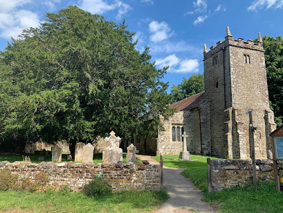
Bronze Age Walks - The Oldest living inhabitant in Dorset at St Mary’s Church, Lychett Matravers, Dorset


A walk to locate an ancient Yew tree about 1750 years old in Lytchett Matravers in Dorset. 


(50°45'45.4"N 2°05'17.9"W) Walk starts at Colehill Road


(50°45'54.0"N 2°05'32.7"W) St Mary the Virgin Church


(50°45'54.7"N 2°05'32.9"W) The Yew tree (circa 280 A.D.)


Bronze Age Walks are a collection of short, filmed walks with maps defining ancient sites.


(50°45'45.4"N 2°05'17.9"W) Walk starts at Colehill Road.

©paint walk July 2020
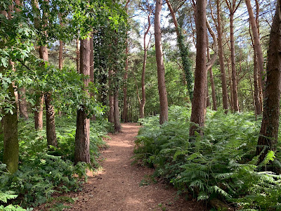
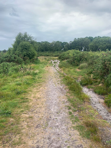
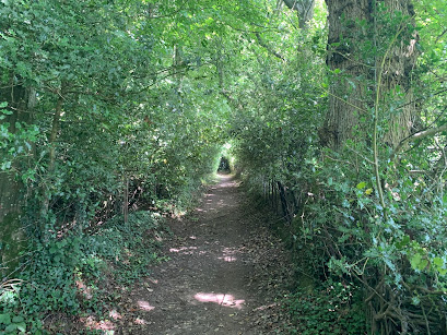
Go through the side gate and continue through the trees.
©paint walk July 2020

Then the walk gets steeper towards a bend. The last time I went it was dry but I do remember that it can get muddy after heavy rain. At the bend is a seat looking towards the church. 

©paint walk July 2020

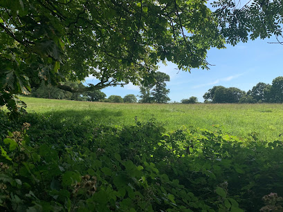
From here the walk becomes shallower and starts to open out into fields.

©paint walk July 2020

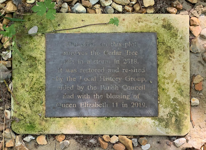
On the left is a fenced cutaway celebrating a tree that was planted in 1938 and blown over by a storm in 2018. This was marked by a two plaques showing the dates. It is clear that the people of Lytchett have a relationship to their trees!

©paint walk July 2020

As you walk down past through the graveyard and past the church to the west side you will find the two yews. The closest to the gate is the oldest.

©paint walk July 2020

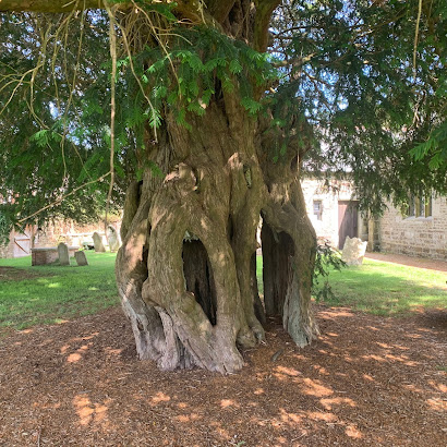
In the churchyard, just outside to the west is a yew tree that in the 1980s was dated to be at least 1,700 years old. Its location here next to the church suggests the spot has been a holy place since before the current church was built.

©paint walk July 2020
The Yew has a girth of 7 metres its possible to stand in the middle of the trunk. The Yew tree is largely poisonous and has a long history within Paganism.  


HISTORY


Lytchett Matravers was recorded in the Doomsday book of 1086 where it was part of the Cogdean Hundred. The Hundred refers to an administrative division of a larger geographical area.


In 1066 a Danish lord called Tholf held the Manor of Lytchett but after the Norman invasion it was granted to Hugh Maltravers whose family held the area for the next 300 years. 


Around 1200 The Church was built by the manor possibly during the crusades when the knight would have been in absence. Within the churchyard are two Yew trees one of which turned out to be 1700 years old. 


This would make the tree in place some at 280 AD  nearly 1000 years before the church was built. WIKI REF: Lychett Matravers Yew Tree.


Please take a look at the video 

https://youtu.be/hQ-33Kx98Rw


To put this in European historical context The Roman Empire was still the dominant power and regional religion would have largely been Pagan. 


It is possible that Sir Walter Maltravers ordered the church to be built beside the manor house during a crusade in his absence around the year 1200. Next to the church are two large yew trees. One of which was dated in the 1980s to be at least 1700 years old.


Bronze Age Walks


Bronze Age Walks with an iPhone are a collection of short, filmed walks with maps defining ancient sites. The emphasis is on Neolithic, Bronze Age and Iron Age because I find them a good lodestone for a walk. 


The walks are usually not a great distance so you don’t have to be super fit to do them. In fact Bronze Age Amble would work. They largely stick to recognisable paths but it is probably a good idea to protect your legs a bit as gorse can be fairly prickly and common in places.


Bronze Age Walks

Cannon Hill 3 Bronze Age Barrows

Summerlug barrow and hill - Holt Heath - Wimborne - Dorset

Bronze Age Walks-Bee-Garden-Holt-Heath

Bronze Age Walks The Oldest living inhabitant in Dorset


Dorset heathland
Part 1  Part 2  Part 3  Part 4 


Monday, July 13, 2020

Bronze Age Walks - The Bee Garden - Holt Heath - Wimborne - Dorset

A walk to locate the Bee Garden. An earthwork enclosure  on Holt Heath National Nature Reserve. 


Holt Heath is a protected National Nature Park North of Wimborne Minster in Dorset.


Bee Garden (50.836802, -1.922901)

Parked at map ref (50.8322705,-1.9350979,509)


Bronze Age Walks are a collection of short, filmed walks with maps defining Bronze Age sites.


Please take a look at the video 

https://youtu.be/SrADjozUciI

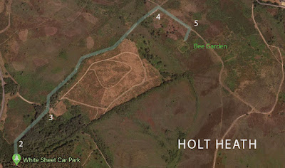
Walk starts from the White Sheet car park at the parking label on map.

Google maps
Map Of Bee Garden Walk (Click to enlarge)

Walking from the car park go through the small gate on the north side of the car park. This will take you a short distance through some woods where you join another track and go right.


Carry on until the woods end and you will find a three way path. Take the left-hand path towards the road And follow it until you reach a crossroads.

©paint walk 2020

Turning right at the crossroads there is a shallow descent down a wide path.  Passing a line of Scots pine on the right you come to the entrance of the Bee garden. 

©paint walk June 2020
This was quite  hard to find. The gorse had grown thick and the entrance is completely obscured. I Walked back about 20 feet and went round the edge of it.
©paint walk July 2020

Walking diagonally you can find small paths. you will definitely notice the ditch and ramparts. The ramparts is about a metre high and the ditch about the same. From the bottom of the ditch its height is about 2 m or 6 1/2 feet. it’s a steep scramble to the top.

Artist illustration of a medieval bee garden

Ramparts are well defined and it looks to be squarish in shape. It’s actually 26.5 x 22.8 metres (29 x 25 yards) in size. There are some really good views of the heath from here. I went in June and the purples and yellows were just starting to come out.

©paint walk 2020

HISTORY


Bee gardens were an important part of heathland life from the Medieval period. The hives had changed little since the Roman occupation. Bell shaped baskets called Skeps were put on small platforms that could be moved throughout the pollen season. 

Artist impression of a heath bee garden

The main product of the bees work was the honey and beeswax they produced. Honey was used both for food sweetening and also for the many medicinal purposes it can perform. Fermented honey also made Mead a medieval beer.


But beeswax was the most profitable product for the beekeepers. The beeswax was used for the church candles because the tallow candles the commoners used was considered of an impure light and too smelly for services. It was also in demand by the nobility of the times both for lighting and wax seals.

The Beekeepers, 1567 by Bruegel the Elder

This area of Holt heath is still known as the Bee garden today and its rectangular shape would certainly keep the worst of the wind and weather from the skeps. But if this was built as a bee garden then the earthwork enclosure built round it at some 2 - 3 metres in height seems like a fortification .


This would be far more practical as an animal enclosure or as a local meeting place similar to a Moot still visible in the area. Is it Bronze Age? Maybe, maybe not and until some excavation or ground work is done the answer is unknown.    


ABOUT BRONZE AGE WALKS


Bronze Age Walks with an iPhone are a collection of short, filmed walks with maps defining Bronze Age sites. The emphasis is on Neolithic, Bronze Age and Iron Age because I find them a good lodestone for a walk. 


The walks are usually not a great distance so you don’t have to be super fit to do them. In fact Bronze Age Amble would work. They largely stick to recognisable paths but it is probably a good idea to protect your legs a bit as gorse can be fairly prickly and common in places.


Bronze Age Walks

Cannon Hill 3 Bronze Age Barrows

Summerlug barrow and hill - Holt Heath - Wimborne - Dorset

Bronze Age Walks-Bee-Garden-Holt-Heath

Bronze Age Walks The Oldest living inhabitant in Dorset


Dorset heathland
Part 1  Part 2  Part 3  Part 4 

Monday, July 6, 2020

Bronze Age Walks - Summerlug barrow and hill - Holt Heath - Wimborne - Dorset


©paint walk June 2020A walk to locate a Bronze age barrow on Holt Heath National Nature Reserve. 


Holt Heath is a Nature Park North of Wimborne Minster in Dorset.


Summerlug barrow (50.8430860, -1.9038620)


Summerlug hill (50.8426202, -1.9040965)


Parked at map ref (50.8436743, -1.9082170)


Bronze Age Walks are a collection of short, filmed walks with maps defining Bronze Age sites.


Please take a look at the video 

https://youtu.be/1nNY6dE-FGY


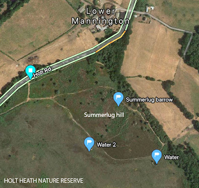
Walk starts from Holt road at the parking label on map.
Summerlug Hill - Bronze Age Walks
Map of Summerlug Hill

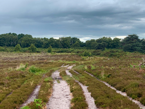
Walk from the entrance till you meet the main path and turn left. Keep walking until you come to a fork in the path. I went left around the north of the hill. You can go left or right here it doesn’t really matter, as it’s a circular walk. 

©paint walk June 2020

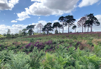
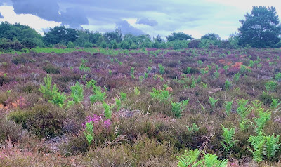
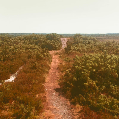
Summerlug hill is on the edge of the heath. You can find gorse, bracken and foxgloves in plenty at the right time of year. Occasionally you can hear Curlew calls.
©paint walk June 2020

Just round the top of the hill you can find Summerlug barrow on the right hand side. It’s not signposted. The problem with finding the barrow depends on the time of year and how overgrown it is. 
©paint walk June 2020
Summerlug barrow looking west. The barrow is on the right.
(click to enlarge)
The path entrance will be visible and its on the right. Once you see the mound it will be more obvious because its not far from the entrance.
©paintwalk jun 2020
Summerlug hill (click to enlarge)
After going back onto the original path turn right down the hill. As it descends the heath opens out and you can take the wider paths to the right along the south side. 
©paint walk June 2020


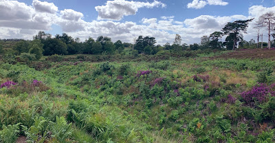
The views give a good panorama of Holt heath. Following the path back up the west of Summerlug hill you meet up with the start of the walk and you are pretty close to the entrance again.

©paint walk June 2020

HISTORY


Possibly the three barrow marks a boundary of land ownership but as this is near the edge of the current heath boundary it is difficult to decide. To the North West is another barrow so it seems likely that these two would be related to each other. As with most heathland the landscape has remained largely unchanged for 3000 + years.


ABOUT BRONZE AGE WALKS


Bronze Age Walks with an iPhone are a collection of short, filmed walks with maps defining Bronze Age sites. The emphasis is on Neolithic, Bronze Age and Iron Age because I find them a good lodestone for a walk. 


The walks are usually not a great distance so you don’t have to be super fit to do them. In fact Bronze Age Amble would work. They largely stick to recognisable paths but it is probably a good idea to protect your legs a bit as gorse can be fairly prickly and common in places.


Bronze Age Walks

Cannon Hill 3 Bronze Age Barrows

Summerlug barrow and hill - Holt Heath - Wimborne - Dorset

Bronze Age Walks-Bee-Garden-Holt-Heath

Bronze Age Walks The Oldest living inhabitant in Dorset


Dorset heathland
Part 1  Part 2  Part 3  Part 4 


Historic England Maps and information.

https://historicengland.org.uk/listing/the-list/list-entry/1015999


Friday, June 5, 2020

Dorset heathlands from the 20th Century

Dorset Heathlands 20th Century (part 4)
In the 20th century the heath gradually succumbed to the increasing pressures from agriculture, forestry and urbanisation. In 1919 the Forestry Commission were given the task to plant trees where ever they could, but by 1930s the traditional uses of the heath had greatly declined. The landscape was reduced to about 8000 hectares and was fragmented into over 100 sites. 

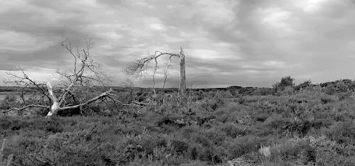
Gravel, sand and clay were needed for more roads and buildings adding the heaths decline. When the scrub was no longer kept in check by grazing and fuel gathering, the birch and pine trees began to take over the landscape. During this time period bird and reptile numbers decreased by up to 85%.

© paintwalk 2020
Holt Heath
The World Wars saw the firm establishment of two major military ranges at Povington and Bovington, the home of the Royal Armoured Corps and a major cordite manufacturing facility at Holton Heath. 

Studland and Godlingston Heath were both used as rehearsal sites for the D-Day landings, including trials for duplex drive tanks, several of which still lie offshore as wrecks. Both of these sites are in part National Nature Reserves.

Studland beach pill box (WW2)
By the late 20th century, additional pressures on the heathland included landfill in many of the worked-out sand, gravel and clay pits. Some large-scale open cast extraction of both ball clay and aggregates continued to change the landscape. 

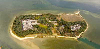
On Winfrith heath a nuclear power station was built although it has now been decommissioned. There is also the site of the UK’s largest onshore oil field at Wytch Farm on the south shore of Poole Harbour. 
© perenco
Wytch Farm
By the early 1970s people were becoming more aware of the impact they caused on this landscape and started to protect what was left. Gradually groups and petitions were formed to save what was left of this important rural landscape.

The heathlands are very much part of Dorset history and if walked and read with a little knowledge, show traces of habitation and use for 4000 years. The wildlife and fauna create another layer to these places and contain a rare and rich eco system within it.

You can see from the map below the amount of heath lands left in Dorset. The black shapes reveal the amount left and the place name map reveal their largest extent.
Existing Heathlands shown in black
What’s left of the Dorset heathland now has legal protection and dedicated volunteers to record and help save this valuable environment. Commoners rights still apply to some of the Dorset heaths for example Holt heath. They can sometimes be found by areas of heath where wild horses roam. For a full list of common ground search for “Database of registered common land in England.”
Current extent of Dorset heathlands. Areas marked by red outlines.
© paint walk 2020


Dorset heathland
Part 1  Part 2  Part 3  Part 4 


Thursday, June 4, 2020

Dorset heathland history 3 the enclosures

1750 to 1919 The enclosures acts

By the 1750s The heath lands of Dorset spread from the Avon Valley in the East, across Purbeck as far as Dorchester in the West. There was 50,000 Hectares of heathland crossed only by the river valleys of the Piddle, Frome and Stour.

Paintwalk 2020
Dorset heathlands extent until enclosure heath shown with a current map 
The heath played an important part of the rural economy and local communities took a living from them until the enclosures act of 1805 which determined much of the ownership of the heath. 

The enclosures that occurred between 1750 and 1820 dispossessed former occupiers and farmers from some 30 percent of the agricultural land of England. Through the Acts, “open fields” and “wastes” these lands were closed to use by the peasantry. 

Open fields were large agricultural areas to which a village population had certain rights of access and which they tended to divide into narrow strips for cultivation. The wastes were the unproductive areas for example, heathlands, fens, marshes, rocky land, or moors to which the peasantry had traditional and collective rights. Including access in order to pasture animals, harvest meadow grass, fish, collect firewood, or otherwise benefit. (7)
Enclosure in England during the 18th and 19th Century
Rural labourers who lived on the margin depended on open fields and the wastes to fend off starvation. This meant if you were not a land owner you had to accept the situation or give up the way of life and move to the increasing industrial towns and cities to earn a wage. This was at a time when the first Industrial Revolution was beginning to change society in major ways.

They hang the man, and flog the woman,
That steals the goose from off the common;
But let the greater villain loose,
That steals the common from the goose.
English folk poem

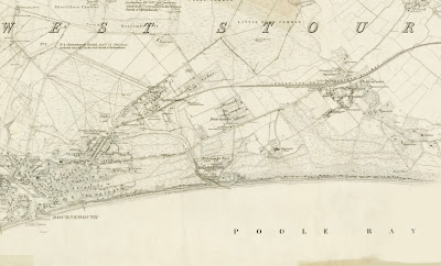
One of the first effect of the enclosures on the Dorset heathlands was that several of the new private owners planted the heath with pine to “improve the area“. This was to be beginnings  of Bournemouth. By claiming the heaths under the enclosure act building and construction would begin to remove large parts of the heath.
Reproduced with the permission of the National Library of Scotland
Bournemouth Map 1870 (click to enlarge)

Reproduced with the permission of the National Library of Scotland
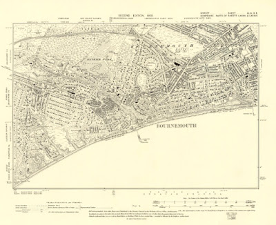
Bournemouth map 1900 (click to enlarge)
In 1851 population of Bournemouth was 695, by 1881 the population has increased to 16,000. (8) This was helped by the new train routes where Victorians would come for the pine walks and sea air as a remedy to help cure Tuberculosis a common disease at the time.


Tuesday, June 2, 2020

Dorset Heathland History 2 Middle Ages

1200 -1500 the Middle Ages

In the Middle Ages The heaths were used as commons. “Common Land,” means a place where the rights of the Common may be exercised. The rights to Common Land were granted by the land owners to local families.

Common rights may have been granted to serfs who would have been indentured to the lord of the manor. As part of their servitude they would be granted rights to a small amount of land and certain Common rights.

© Paintwalk 2020
Rights of Common included:

Rights of Pasturage: You can graze live stock.
Rights of Turbary: You can gather Peat and turf for fuel, Heather for roofing, fodder and bedding for animals.
Rights of Estover: You can take specific timber products from the land.

The Common rights depended on the environment of the landscape and the permission of the land owner. The people who chose to exercise these rights were known as Commoners. During this time the Dorset heaths would have been mainly used for grazing, fuel and timber. Some heaths in Dorset still carry the name “Common” and a few still have some Commoners rights.

With the arrival of the Black Death in 1348 and after the peasant revolt of 1381, serfdom began to decline in England. By the end of 1300s the Black Death had killed between 30 to 60% of the population. With the smaller number of workers available the grain production began to fall. 

Peasants began to demand higher wages for their labours, and this was not popular with the landowners. Land Rights were replaced by Copyhold a new form of tenure to the landlord. 
Farming circa 1520
Up until the 1400s prestige had been an important role for the landlord but with a dwindling supply of serfs and wages to pay, the landowners started to use the land in more profitable ways.

The landowners began to enter themselves for offices like justice of the peace, sheriff and member of parliament. The landed gentry took advantage of these new positions and corruption became widespread. Their effect on the heathlands would lead to enclosure. 
The English Gentleman
Enclosure simply meant that once a landowner had secured a fence around an area, all of the rights belonged to them. This left many tenants without the land they needed to grow food for themselves.

Dorset heathland
Part 1  Part 2  Part 3  Part 4   

(4) Serfdom wiki
(6) Landed gentry wiki

Monday, June 1, 2020

Dorset heathland history 1 Geology and prehistory

Heath lands in Dorset.

© paint walk 2020
The East Dorset heathland is not a natural habitat. The truth is that most heathlands are ancient landscapes that were created and maintained by people for over 4000 years.

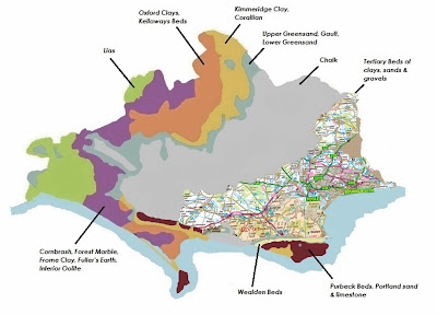
The underlying geology of South East Dorset is Tertiary Sands created between 2 to 65 million years ago, bringing nutrient poor and well drained soils which already suited the development of lowland heaths.


By the Bronze Age (2500 - 800 BC) settlements were common on the the Dorset heaths. There were many Bronze Age settlements in Dorset with barrows, burial cremation chambers and standing stones (the Devils Stone - Bere Regis) which still remain on these heathland sites today.

By the middle of the Bronze Age (1) the ground had become as we see it today. Trees were cleared by Bronze Age farmers to make fields and the cleared wood was used for building homes, fences and shelter for livestock and fuel.

Removing trees and planting crops lead to a continuous increase in soil acidity and a reduction in the nutrient content. Gradually this lowered the fertility of the soil and farming became less viable. In the environmental change that followed the land became more favourable to gorse, heathers and heathland grasses. The landscape would have probably been dotted with silver birch and Scott’s Pine which managed to grow well in these soil conditions. 

If the trees had not been felled in this way it is likely that the quick growth of birch would have blocked enough sunlight to the soil to cause the heathlands to eventually return as woodland. (2)

© paint walk 2020
By the Iron Age (650 BC - AD 410) the heaths were largely unoccupied with the population moving towards the more fertile lands to the west for crop growing. The heathlands were still being used for grazing and fuel, but by the mid Iron Age local clays were also being used for pottery and the gorse used for the firing. 

Early Iron Age potters used clay originally from the Southern Purbeck ridge, but by the first century the settlements were using the clays from around the Poole Harbour basin. The clay pits were adjacent to each other, from Broadstone to Upton where the beacon hill pits still rest underneath the current caravan site at beacon hill. There are surviving brickworks in use today near the area. (3)

The market for the pottery was probably increased with the arrival of the Romans, and many examples of black burnished ware pottery can be dated from this period.

Dorset heathland
Part 1  Part 2  Part 3  Part 4 
(1) Social relations in later pre history by Niall Sharples OUP Oxford 2010


Paint walk